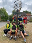
Leader: DerekS, DerekM
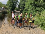
Riders: Jo, Mike G, John, Anne H, Rhona, Simon, Ian T, Mike P, Anne S, Mal,
Distance: 43.3 miles
Two very similar routes, one clockwise, the other anticlockwise.
Weather report for 2022-08-18 (between 09:00 and 17:00)- Wind speed 7 mph, gusting 16 mph, from the S (varying between SE and SW)
- Temperature average 23°C (19min/25max)
- Feels like 23°C (20min/24max)
- Sun 7.0 hours, cloud cover 54%
- Rain 0.40 mm
Blue
(Download route as gpx file)- Total Distance: 43.03 miles
- Climbing: 1963.7 ft
- Descending: -1926.3 ft
- Max elevation: 250.9
- Min elevation: 8.2
- Elapsed: 06:26:43
- Moving: 03:25:01
Red
(Download route as gpx file)- Total Distance: 43.71 miles
- Climbing: 1961.4 ft
- Descending: -1978.2 ft
- Max elevation: 250.9
- Min elevation: 9.2
- Elapsed: 05:18:01
- Moving: 03:07:42